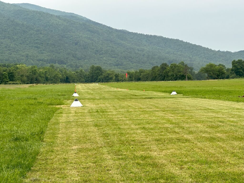
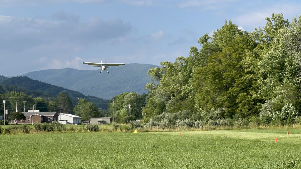
Touchdown Zone: Brown
Region: United States
Surface: Thick grass
Elevation: 1,575 feet
Length: 427 meters/1,400 feet
Width: 12 meters/40 feet
Slope: 1-2%
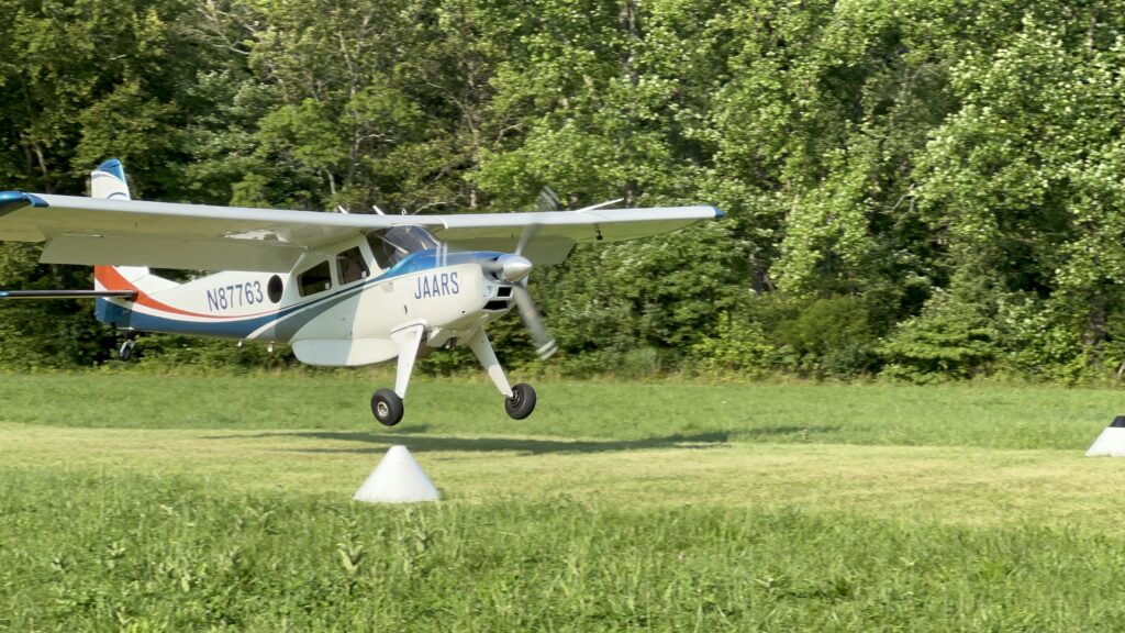
People Served: Pre Field Orientation trainees
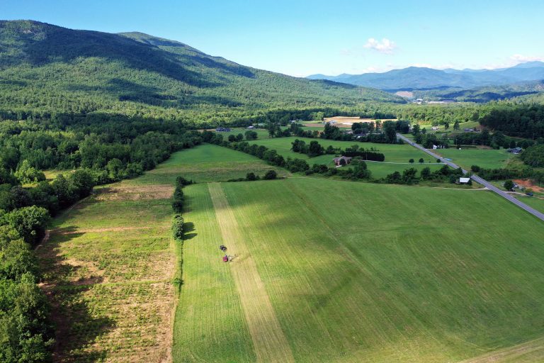
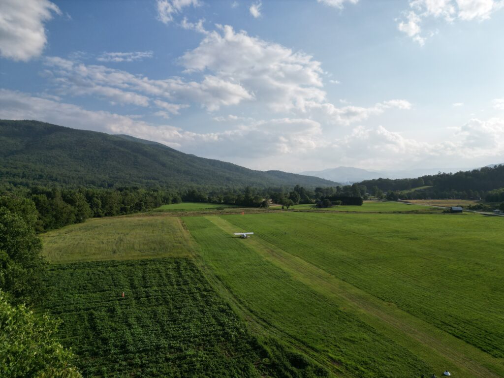
Interesting Facts: Most of the time, Brown is a hayfield located in the western mountains of North Carolina. But it gets transformed by the trainees into a runway once a year for use during Mountain Week, the final week of the JAARS Pre-Field Orientation (PFO) advanced training program. During Mountain Week, PFO trainees learn how to survey and set up a runway. Additional benefits of Brown include specialized training for landing on runways located in mountainous regions. For instance, the pattern for approaching this runway is modified from a normal rectangular pattern because of the nearby terrain. Plus, pilots need to understand how to deal with the optical illusions created by the nearby mountains and the overall slope in the valley, as well as some surface undulations similar to those commonly found on unimproved airstrips overseas. These factors, added to almost constant winds, make Brown one of the more-challenging runways JAARS uses for training. Find out more about Brown and other runways used in Mountain Week PFO training.
View a Helio Courier take off at Brown